


Multimodal Transportation (Walking, Bicycling, Transit, Driving)
Route 236 Traffic & Safety Improvements
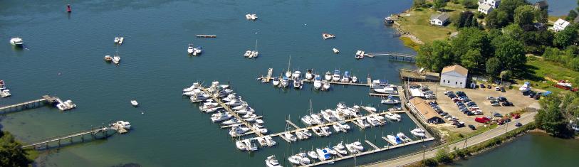
The Town continues to work with agency partners on improving traffic and safety on Harold L. Dow Hwy. (Route 236). Kittery Area Comprehensive Transportation System (KACTS) has funded and led two Route 236 corridor studies to collect data and input and make recommendations to improve traffic and safety along the route. KACTS closely involved the Town and MaineDOT on these studies. Some of the recommendations include improvements to existing intersections and traffic signal equipment, better signal timing, a center turn lane, new or extended turn lanes at intersections, possible planted medians, and improvements for people walking and bicycling. You can find those corridor studies here.
The Town and MaineDOT have entered into a cooperative agreement to begin design of some of those improvements between Depot Rd. and the Kittery Town Line. Surveying has begun, and the design work is expected to kick off in Spring 2024.
A pair of projects will improve two Route 236 intersections on the north side of town: Goodwin Rd./Dover Rd. (Route 101) and State Rd. (Route 103). The Town and MaineDOT have also entered into cooperative agreements for the design phases of these projects. Some surveying has been done, and the design work is slated to start in Spring 2024. The design phases are funded 80% by a KACTS grant and 10% by MaineDOT, with the Town's share being 10%. Improvements recommended by the corridor study for these two intersections include: extending a turn lane that backs up at Goodwin Rd., better signage and pavement markings, better channelized right turns, improvements to the existing signal, and a sidepath that would serve as a segment of the Eastern Trail and East Coast Greenway. Since the study found that a traffic signal may be warranted at State Rd. (Route 103), we expect this design phase to further evaluate that possibility.
State-Beech Active Transportation & Infrastructure Project
The Town of Eliot is moving forward with design work on our first expansion of our walking and bicycling network, beyond just one section of State Road.
We have begun the design of sidewalks and shoulders for people walking and bicycling on State and Beech Roads in and near the Village area. These facilities will help more people access the Village area on foot, with a wheelchair or other assistive mobility device, or on bike.
They will also improve Safe Routes to School for Eliot Elementary, an on-road segment of the Eastern Trail & East Coast Greenway, and recreation options for Eliot residents.
After a qualifications-based selection process, the Town hired a consulting team led by Stantec to lead the design of the project. The initial design phase, funded by American Rescue Plan Act (ARPA) funds, included surveying, initial public engagement and abutting property owner notification, initial environmental and utility coordination, and the development of 10% plans. As these are State-maintained roads, we are maintaining communication with MaineDOT.
Town receives DOT grant funding to move the project forward
In January 2024, the Town was awarded $304,000 from the MaineDOT Bicycle and Pedestrian Program allowing us to complete the design and right-of-way phases for the Beech Rd. portion of the project as well as parts of State Rd. This funding is included in MaineDOT's Three-Year Work Plan for 2024-26. (See also the Work Plan's Eliot projects in the attachment list below.) It will cover 80% of the project cost, with a 20% match ($76,000) to be provided by ARPA funds.
10% Design Plans completed
The 10% design plans are completed and can be accessed in the Attachments list below.
Public Information Session on Design Plans - June 26, 2023
Thank you to everyone who attended this Public Information Session. We had over 20 attendees in person and over 10 on Zoom. A video of the meeting is here. Links to the 10% plans and meeting presentation are below.

Eastern Trail Feasibility Study
Maine's Eastern Trail (which is part of the East Coast Greenway) goes through Eliot as an on-road signed route. The Town is a participant in the Eastern Trail (ET) Feasibility Study, which kicked off in the fall of 2023, to explore possible routes for an off-road ET section through North Berwick, South Berwick, Eliot, York, and Kittery. This study is primarily funded by the Eastern Trail Alliance and MaineDOT, with small shares requested of each town. The Town is contributing $2,500 in ARPA funding to the study.
Overseen by the planning/engineering firm VHB, the study is evaluating alternatives, costs, potential impacts, and constraints, and it is seeking public input to recommend locations for future segments of the ET between the Route 1 Bridge (Memorial Bridge) in Kittery and North Berwick.
While the ultimate goal of the feasibility study is to recommend a route for a continuous off-road trail, the alternatives include a variety of potential configurations, including modifications to on-road facilities. Potential route options may include:
- Shared-use paths along utility corridors (typically featuring high-tension power lines)
- Shared use path alongside a public road
- Boardwalk segments over wetlands and small streams
- Striped bike lanes or wide shoulders along busy roads
- Travel lane shared by all users on rural roads with low traffic volumes and/or speeds
The 18-month study began in late 2023 and is expected to finish in early 2025. A Technical Advisory Committee (TAC) has been established and meets bi-monthly to help guide VHB’s planning work. Public meetings are expected to be held this spring and towards the end of the year. After completion, the Eastern Trail Alliance, SMPDC, and individual municipalities will seek funding through grants and other sources to implement the priority recommendations from the study.
Kittery Area Comprehensive Transportation System (KACTS) Safety Action Plan
The purpose of the Safety Action Plan is to improve roadway safety by significantly reducing or eliminating roadway fatalities and serious injuries through the development and implementation of plans that focus on the needs of all users: pedestrians, bicyclists, motorists, public transportation users, micro-mobility users, and commercial vehicle operators. The project will identify strategies to improve safety outcomes in communities across the KACTS region: Berwick, South Berwick, Eliot, Kittery, York, Ogunquit, Wells, Kennebunk, and Kennebunkport.
The Safety Plan will develop the tools to help strengthen the region’s approach to roadway safety and save lives. It will also include a list of short-, mid-, and long-term projects that will be eligible for implementation and supplemental planning funds through the Federal Highway Administration’s (FHWA) Safe Streets for All (SS4A) and other federal grant programs. The project team will work to hear the needs of residents, business owners, and daily commuters to understand their experiences and concerns.
KACTS Safety Action Plan web page - includes a link to the recording of the February 29, 2024, Public Meeting at Kennebunk High School
Safety Action Plan Fact Sheet - see attachments list below
Improving Conditions for People to Walk and Bike in Eliot (2021)
In 2021, the Town Planning Office asked residents for input on improving conditions for walking and bicycling, and we received about 75 comments. We held “walking office hours” on four corridors and spoke to neighbors in their front yards regarding their concerns about walkability and bikeability and suggestions for improvements. We heard from Town advisory committees and stakeholder agencies, and researched Town policies, safety data, and other background information. We held a public information meeting and continued to collect more public comments. All this informed the report, “Improving Conditions for People to Walk and Bike in Eliot”, which was reviewed and adopted by the Select Board on December 9, 2021. (See link below.) The report will serve as guidance to inform future Town investments in sidewalks, paved shoulders, and other facilities.